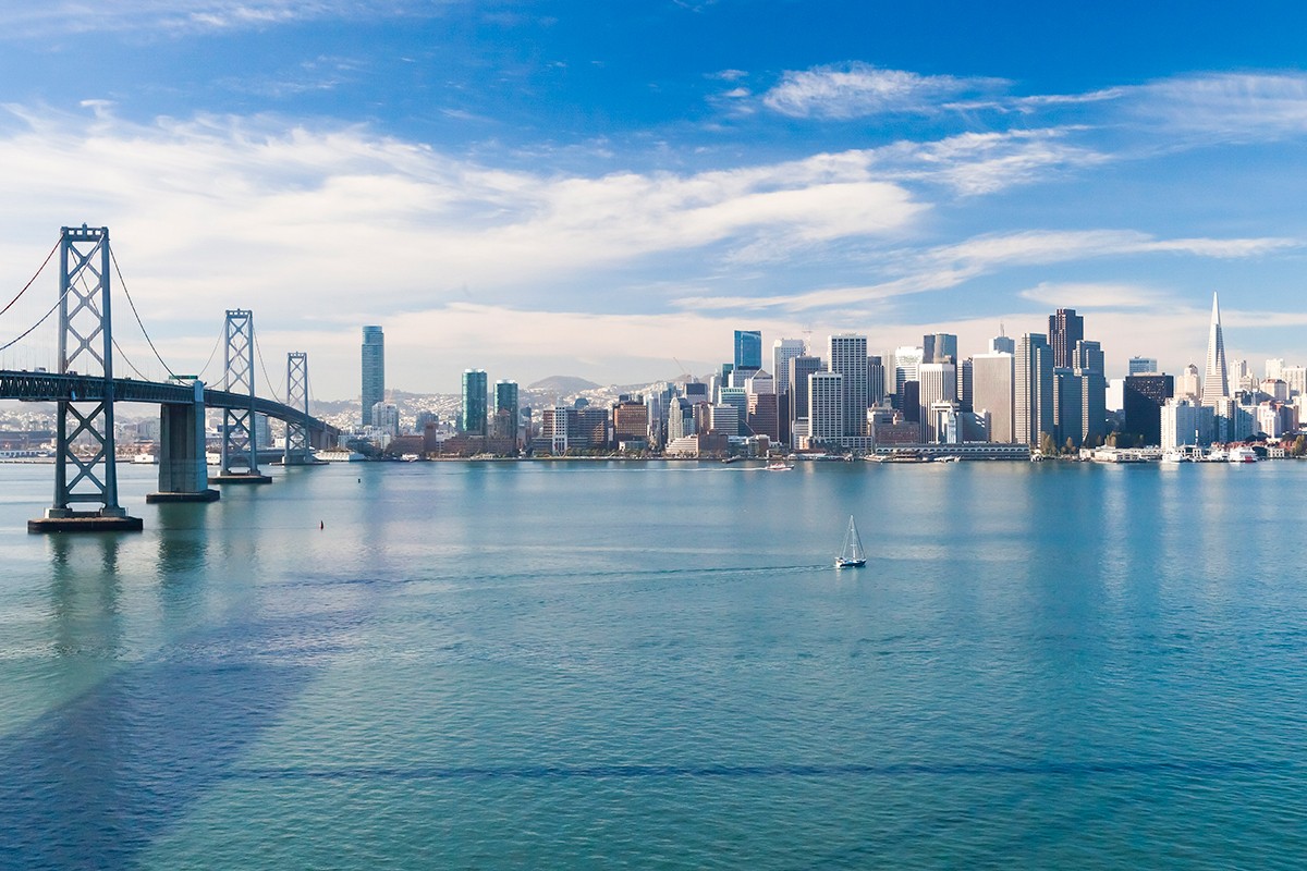

As climate change raises sea levels, feeding storm surges, coastal cities are increasingly at risk. How can vital transportation networks be protected in such scenarios? NYU Abu Dhabi's Samer Madanat, dean of engineering, is working with researchers at the University of California at Berkeley (UCB), where he once taught, to help answer that question.
Supported by the National Science Foundation (NSF), a four-year study of California’s San Francisco Bay area, Madanat said, may eventually prove to be useful in other big coastal cities like Abu Dhabi and Dubai.
The researchers must solve a series of complex problems, he explained, starting with hydrodynamics and ending with political science:
- how much flooding to expect and where;
- potential impacts on roads and traffic;
- how to best allocate resources to protect shorelines;
- and barriers in government to react effectively.
Madanat explained how Mark Stacey, professor of civil and environmental engineering at UCB, uses complex state-of-the-art software developed by the U.S. Geological Survey to assess storm surges: “the extent of flooding given the topology of terrain near the coast, which allows him to predict which highways will be flooded.”
If we're going to protect the shoreline, how are we going to decide which areas to protect, given limited protection resources?
Stacey and his students can now, Madanat said, “predict things at a fairly high level of resolution. If there were a half-meter sea-level rise, say, and if for example San Francisco County protected its shore, they can say what would happen to Alameda County.”
That data, Madanat said, becomes “an input into the transportation component of the research” that he’s leading with Alexei Pozdnukhov, assistant professor of civil and environmental engineering at UCB.
Their goal is understand what happens to transportation networks when water hits, how drivers change their routes, and where to build levees or other infrastructure to protect highways and bridges. Madanat is also working with a postdoctoral researcher in Abu Dhabi and a PhD student in New York.
“Alexei has developed simulation tracking of commuter movements, calibrated in part by use of cell phone location data.” With this, Madanat went on, “they can predict how people are going to … take detours or even delay their trips if planned routes are cut due to flooding.
“But for more long-term events, with sea-level rise, people are going to gradually learn new routes … and these will impose an added delay. So my part is about this: if we’re going to protect the shoreline, how should we decide which areas to protect, given limited protection resources?”
Madanat went onto explain how the researchers have “developed the mathematical formulation for this optimization problem, of where you put levees, to minimize total additional hours or kilometers traveled.”
Extra layer of complexity
So far, however, the resource-allocation optimization work has assumed a single decision maker allocates the funding to achieve an optimal solution for the Bay Area at large, which has nine counties.
Building shoreline defenses in one could make flooding worse in others, Madanat explained, so the problem becomes more complex if the counties make decisions independently of one another. Further, individual municipalities, within counties, could undertake some projects, which may protect them individually but increase the flood risk for their neighbors.
The situation becomes the type of game-theory issue known as a Stackelberg game: which counties will lead, which will follow, and what will happen?
Enter the political science part of the research. Mark Lubell, director of the Center for Environmental Policy and Behavior at the University of California at Davis, “has been meeting with county and city officials,” Madanat explained, “and has identified two or three counties that are ‘first movers’.” With that information, “we’re attacking what happens when each county operates alone.”
The engineers understand that politicians don’t always cooperate smoothly. “Asymmetries in the influence matrix may make joint governance difficult,” the researchers’ proposal to the NSF noted.
What’s learned in San Francisco Bay may prove useful far from there, Madanat noted. “The coastline of the UAE is very susceptible to inundation, even with less than half a meter of sea-level rise,” and local officials “are starting to pay attention. My long-term objective, maybe with additional funding, is to replicate this approach in the UAE.”